c. 1950–1970
Cotswold
Cotswold is the connective tissue between the historic east side and SouthPark — a mid-century neighborhood in the middle of a construction-led transformation.
Character
Living in Cotswold
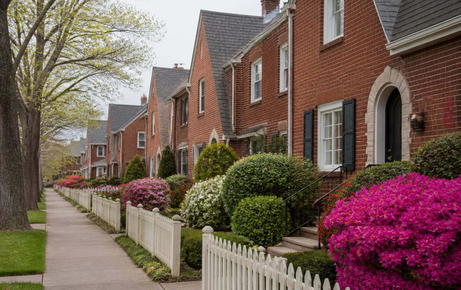
Half the streets still read as 1958; the other half are lined with 3,500 sq ft transitional new builds. Lot size is the driver.
Land value in Cotswold has largely decoupled from the existing house. Buyers frequently price the dirt.
Families trading up, builders, and buyers who want SouthPark access at an east-side price.
Orientation matters here more than in newer parts of Charlotte. Cotswold sits south of chantilly via randolph and wendover, inside the pre-war street grid that fans east from Uptown along Central Avenue, Commonwealth Avenue and Monroe Road. Uptown is roughly three miles away, Charlotte Douglas International Airport twenty to thirty minutes depending on traffic, and the Briar Creek greenway threads the eastern edge of the corridor with a continuous walking and cycling route toward Cotswold and Freedom Park.
At a glance
- Position
- South of Chantilly via Randolph and Wendover
- Era
- c. 1950–1970
- Home size
- 1,400–4,500 sq ft
- Price band
- High-six figures to $1.8M for new construction
- Lots
- 0.25–0.5 acre
- Architecture
- RanchSplit-levelTransitional new build
- Streets
- Randolph Road · Sharon Amity Road · Greenwich Road · Wendover Road
Highlights
What defines Cotswold
Buying here
How to shop Cotswold
Inventory in the Cotswold portion of the corridor is limited and moves on relationships as much as on listings. Homes described as 1,400–4,500 sq ft rarely present identically: one may retain original heart-pine floors, plaster and a period kitchen, while the house two doors down has been taken to studs. Price the renovation, not the address.
Practical due diligence for c. 1950–1970 housing: electrical service capacity and any remaining knob-and-tube, cast-iron or clay drain lines, crawlspace moisture and encapsulation, roof geometry on steep-gabled Tudor and Craftsman forms, original wood window condition, and whether any rear addition was permitted and detailed properly. Ask for a builder walkthrough alongside the inspection.
Flood context matters on the eastern edge of the corridor. Briar Creek's floodplain has been re-mapped several times; confirm the current FEMA panel and any Mecklenburg County floodplain overlay for the exact parcel rather than for the street.
Renovating
Working on a pre-war house
Most work in Cotswold is renovation rather than replacement, and the difference between a good and a poor outcome usually shows up in the details: roof pitch and dormer proportion, window sightlines, brick and mortar matching, porch column scale, and how a rear addition meets the original roofline.
Where designation applies, exterior changes visible from the street may require review. Interior work is generally unrestricted, but plan mechanical routing early — pre-war floor plans rarely accommodate modern duct runs without thoughtful design.
Schools
Schools near Cotswold
Assignment boundaries change. Verify the current assignment for a specific address with Charlotte-Mecklenburg Schools before making decisions.
Nearby
Eat, drink and walk near Cotswold
Questions
Cotswold FAQ
What kind of homes are in Cotswold?
+
Cotswold is characterised by ranch, split-level, transitional new build housing from c. 1950–1970. Homes generally run 1,400–4,500 sq ft, on lots that are 0.25–0.5 acre.
What do homes in Cotswold cost?
+
High-six figures to $1.8M for new construction Pricing across this corridor is driven less by square footage than by the quality of renovation, the position of the lot relative to Briar Creek's floodplain, and the character of the individual block.
Where is Cotswold in relation to Chantilly?
+
South of Chantilly via Randolph and Wendover. Chantilly itself sits in the 28205 ZIP code of east Charlotte, roughly bounded by Independence Boulevard, Briar Creek, Commonwealth Avenue and Elizabeth — about three miles from Uptown.
Which streets define Cotswold?
+
Frequently referenced streets include Randolph Road, Sharon Amity Road, Greenwich Road, Wendover Road. Streets vary noticeably block to block in canopy, width and housing intactness, which is why local buyers shop by block rather than by neighborhood name.
Who tends to buy in Cotswold?
+
Families trading up, builders, and buyers who want SouthPark access at an east-side price.
Is Cotswold walkable?
+
Cotswold sits inside Charlotte's pre-war street grid, so sidewalks, short blocks and a continuous tree canopy are typical. Most errands still involve a short drive, but the Plaza Midwood, Commonwealth and Elizabeth commercial nodes plus the Briar Creek greenway are reachable on foot or by bike from much of the corridor.
What schools serve Cotswold?
+
Chantilly Montessori is the school physically inside the neighborhood and runs as a CMS magnet lottery program rather than by address. Traditional assignment for Cotswold varies by street. School assignment boundaries in Charlotte-Mecklenburg Schools are redrawn periodically. Confirm the current assignment for a specific street address directly with CMS before relying on it.
Is Cotswold a historic district?
+
Most of this corridor developed between the 1910s and the late 1940s, and several adjoining neighborhoods carry local historic district designation with design review for exterior changes. Designation status differs street by street — verify a specific address with the Charlotte Historic District Commission before planning exterior work.
Keep reading
Guides for this corridor
Nearby