Orientation
The Area
Boundaries, geography, and the shape of daily life in the Chantilly corridor of east Charlotte.
Orientation
The Area
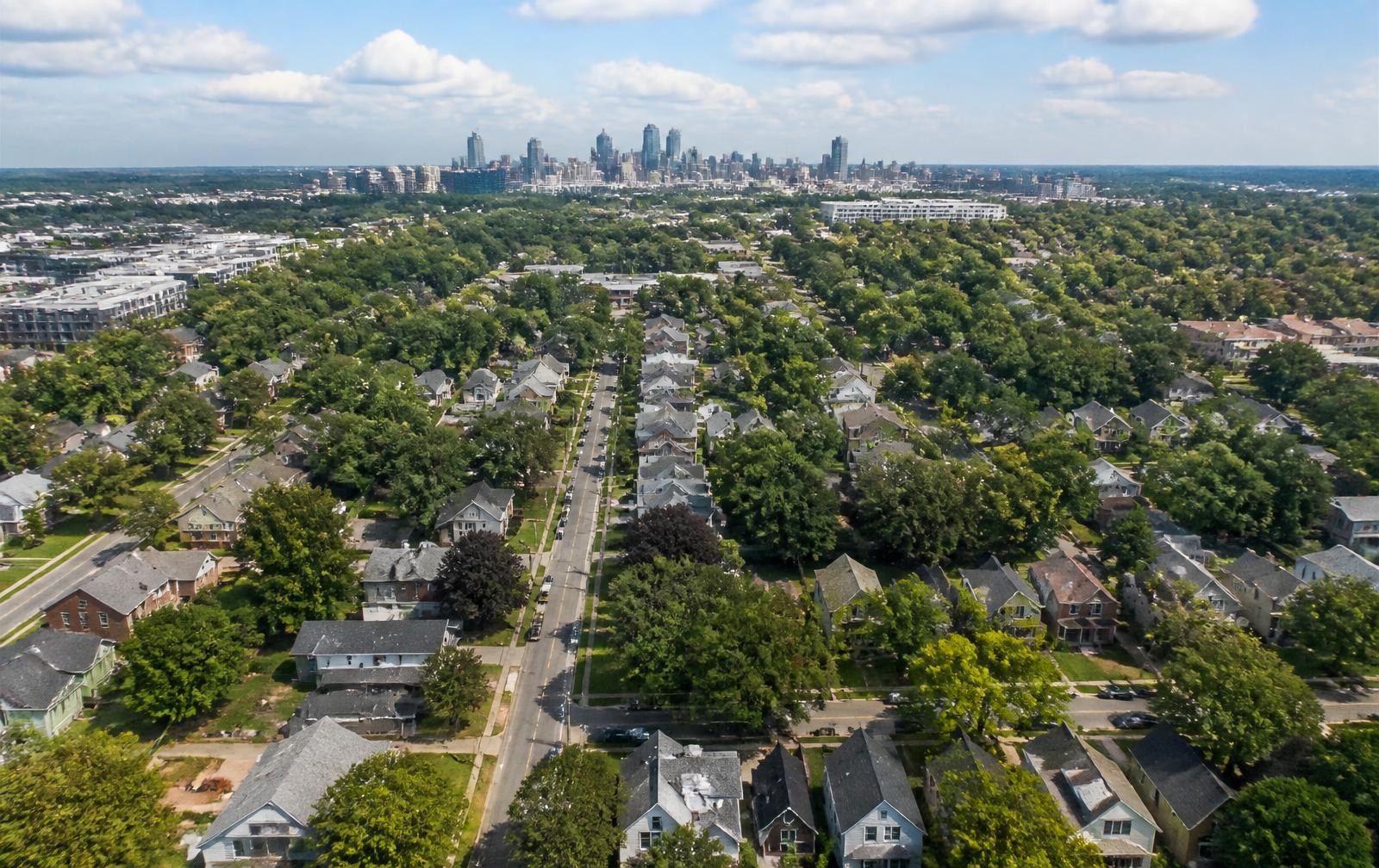
Chantilly occupies a compact wedge of east Charlotte inside 28205, bounded by Independence Boulevard to the south, Briar Creek to the east, Commonwealth and Plaza Midwood to the north, and Elizabeth to the west. Uptown Charlotte is roughly three miles away.
The neighborhood grew as Charlotte pushed east in the early twentieth century, and its housing reflects that: Craftsman bungalows first, then Tudor Revival cottages through the 1930s, then Colonial Revival and Minimal Traditional infill as the blocks filled in after the war.
Daily life orients around a few anchors. Chantilly Montessori sits at the center. The Briar Creek corridor and the Chantilly Ecological Sanctuary form the eastern green edge. Plaza Midwood's restaurants and shops are a mile north, and Elizabeth's medical and college campuses sit immediately west.
What makes the area unusual within Charlotte is completeness. Much of the city has been rebuilt several times; these blocks have not. The canopy is intact, the street grid is intact, and the housing stock still reads as a single coherent period of construction.
Geography
Landform, creek and canopy
The corridor’s shape is set by water. Briar Creek runs north to south along the eastern edge of Chantilly, and the land falls toward it from the higher ground near Commonwealth Avenue. That grade is why the eastern blocks sit lower, why the greenway follows the alignment it does, and why the floodplain program of the late twentieth century concentrated where it did.
The tree canopy is the second defining feature. Willow oaks and water oaks planted as street trees when the blocks were platted are now eighty to a hundred years old, and they form a continuous cover that measurably cools the streets in July. It also imposes obligations: root protection during construction, periodic assessment for storm risk, and city tree-ordinance review for removals on many lots.
Between creek and canopy, the built environment is a tight rectilinear grid with sidewalks on most streets, alleys on a few, and lot widths typically between fifty and seventy feet. The grid is what makes the neighborhood feel navigable on foot despite having almost no commercial frontage of its own.
Corridors
How the four road corridors work
Central Avenue is the neighborhood’s cultural spine, running west into Plaza Midwood and Uptown and east into the international business corridor. It carries most of the corridor’s restaurants, groceries and bus service.
Commonwealth Avenue is the quieter parallel route to the north, connecting Chantilly to Commonwealth Park and Plaza Midwood without the through traffic.
Independence Boulevard is the southern boundary and the fastest route Uptown, but it is a limited-access highway for much of its length here, which means the crossings — not the frontage — determine how the neighborhood connects southward.
Monroe Road heads southeast toward Cotswold and the grocery, service and errand tier most households use weekly. Taken together, the four corridors put nearly every daily destination within a ten-minute drive while keeping the interior streets residential.
Questions
Frequently asked
What are the boundaries of Chantilly in Charlotte?
+
Chantilly sits inside ZIP 28205 and is generally bounded by Independence Boulevard to the south, Briar Creek to the east, Commonwealth Avenue and Plaza Midwood to the north, and the Elizabeth neighborhood to the west. Boundary lines are conventional rather than legal, so listings and city documents sometimes draw them slightly differently.
How far is Chantilly from Uptown Charlotte?
+
Roughly three miles. Most trips run 8–15 minutes by car via Independence Boulevard, Central Avenue, or Elizabeth Avenue, and cyclists commonly use the Briar Creek greenway and Central Avenue bike connections.
Is Chantilly a walkable neighborhood?
+
It is walkable within itself — sidewalks, a tight grid, and a mature canopy — and walkable to the eastern edge of Elizabeth. Reaching Plaza Midwood's commercial strip is about a mile north, which most residents treat as a short walk or a very short drive.
What ZIP code is Chantilly in?
+
28205. That ZIP also covers Plaza Midwood, Commonwealth Park, and parts of the Central Avenue corridor, so ZIP-level statistics describe a much larger area than Chantilly itself.
Does Chantilly flood?
+
Portions along Briar Creek historically flooded, which led to a long program of buyouts that converted the lowest-lying parcels into open space and the Chantilly Ecological Sanctuary. Always check the current FEMA flood map and Mecklenburg County floodplain data for any specific parcel.
Related local guides
Neighboring resources worth a look
- Plaza Midwood neighborhood guide
Chantilly’s northern edge runs into Plaza Midwood along Commonwealth Avenue, and most residents walk or drive there for restaurants and shops. This separate guide covers that neighborhood in the depth we give Chantilly here.
- Living in Elizabeth, Charlotte
Elizabeth sits immediately west of Chantilly and shares the same pre-war housing stock and street grid, so buyers comparing the two corridors will want its street and housing detail alongside ours.
Go deeper