Neighborhood Guide
Chantilly Charlotte homes: the neighborhood guide
Schools, parks, transit, and everyday amenities — the practical map of daily life around Chantilly's homes, in one of Charlotte's most complete intown neighborhoods.
Overview
Daily life, block by block
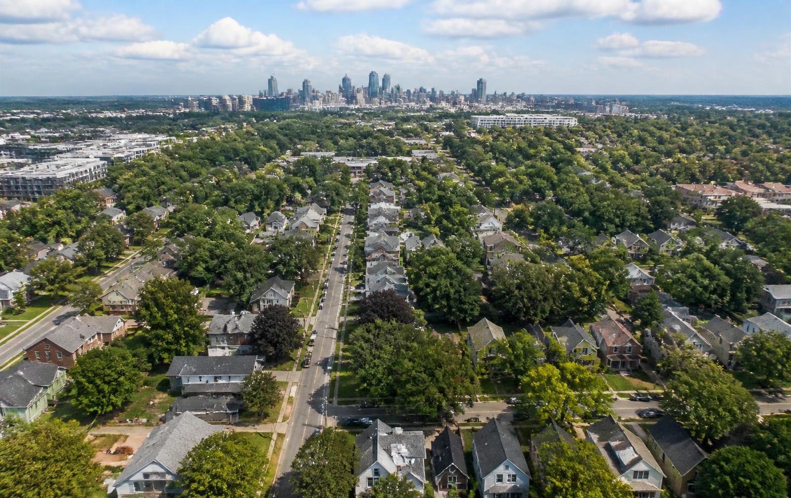
Chantilly works because the essentials layer on top of each other. The neighborhood's own park and ecological sanctuary sit inside the street grid, Chantilly Montessori is woven into the residential blocks, and the Central Avenue commercial district begins about a mile north — close enough to walk, far enough that the side streets stay quiet. Independence Boulevard and Central Avenue carry commuters into Uptown in minutes, and CATS bus service covers the same corridors for car-light households.
This guide organizes that daily infrastructure into four parts — schools, parks and greenways, transit and commuting, and amenities — so buyers, renters, and new residents can see exactly how the neighborhood functions before they commit. For housing stock and pricing context, pair this with the Chantilly homes for sale guide and the walkability analysis.
Schools
Schools in and around Chantilly
Assignment is set by Charlotte-Mecklenburg Schools and changes — verify any address directly with CMS.
Public magnet · PreK–6 · In the neighborhood
Chantilly Montessori
The neighborhood's namesake school and the only Charlotte-Mecklenburg Schools campus physically inside Chantilly.
Public · K–5 · About 2 miles north
Shamrock Gardens Elementary
A community-anchored elementary north of Chantilly with a long record of arts partnerships.
Public · K–5 · About 2.5 miles southwest
Eastover Elementary
One of Charlotte's most established elementary campuses, serving the Eastover area.
Public · K–5 · About 3 miles south
Billingsville Cotswold Elementary
A paired campus carrying one of the most significant histories in Charlotte education.
Public · K–5 · About 2.5 miles east
Merry Oaks International Academy
An IB World School serving one of the most internationally diverse corridors in the Carolinas.
Public · K–5 · About 3 miles east
Winterfield Elementary
A neighborhood elementary serving the Winterfield and Central Avenue corridor.
Public magnet · K–5 · About 2.5 miles southeast
Oakhurst STEAM Academy
A science, technology, engineering, arts, and mathematics magnet in the Oakhurst neighborhood.
Public magnet · 6–8 · About 2 miles west
Piedmont IB Middle School
One of the district's flagship IB middle programs, housed in a historic Uptown-edge campus.
Public · 6–8 · About 2.5 miles northeast
Eastway Middle School
The primary neighborhood middle school for much of the northeast side.
Parks & Greenways
Green space inside the grid
The Ecological Sanctuary and Chantilly Park anchor a network that connects to the Briar Creek greenway system.
About 1.5 miles west
Independence Park
Charlotte's first public park, opened in the early twentieth century.
At the neighborhood's edge
Chantilly Ecological Sanctuary
A restored floodplain wetland on the eastern edge of Chantilly.
At the neighborhood's edge
Briar Creek Greenway
The greenway corridor that follows Briar Creek along Chantilly's eastern boundary.
About 1.5 miles west
Little Sugar Creek Greenway
Charlotte's flagship greenway, running from Uptown south through Freedom Park.
About 3.5 miles southwest
Freedom Park
Charlotte's signature 98-acre park with a lake, fields, and festival grounds.
About 2 miles northeast
Evergreen Nature Preserve
A wooded urban nature preserve with unpaved trails and heavy tree cover.
About 1.2 miles north
Veterans Park
A neighborhood recreation center and park serving the Plaza Midwood area.
About 2.5 miles northwest
Cordelia Park
A historic park with one of the best skyline views in the city.
About 1.3 miles north
Midwood Park
A small, deeply shaded park at the center of the Midwood bungalow district.
The Chantilly Ecological Sanctuary is the neighborhood's signature green space — a preserved woodland corridor along Briar Creek with soft-surface trails — and Chantilly Park provides the fields, playground, and gathering space at the center of the grid.
Transit & Commuting
Getting around from Chantilly
Driving
Three corridors lead west into Uptown: Independence Boulevard (US-74) for the fastest run, Central Avenue for a surface-street alternative through Plaza Midwood and Elizabeth, and Elizabeth Avenue for the southern approach. Off-peak, Uptown is typically 8–12 minutes; rush hour stretches that to 15–20. Eastbound, Independence connects to Matthews and the Monroe corridor.
Bus
CATS operates frequent service on the Central Avenue corridor — including the CityLYNX Gold Line streetcar connection at its western end — and on Independence Boulevard. Most Chantilly addresses sit within a 10–15 minute walk of a Central Avenue stop.
Biking & walking
Uptown is roughly three miles by bike using the marked routes through Elizabeth and the greenway connections along Briar Creek. Inside the neighborhood, the pre-war street grid, sidewalks, and short blocks make most daily errands walkable — one of the reasons buyers shortlist Chantilly in the first place.
Airport & regional
Charlotte Douglas International Airport is about 20–25 minutes via Independence and I-277/I-77. The Amtrak station on North Tryon is roughly 15 minutes north.
Amenities
Dining, markets & everyday errands
Central Avenue's Plaza Midwood district begins about a mile north; daily needs line the Independence and Central corridors.
Restaurants & coffee
- Soul GastroloungeSmall plates, sushi, global · About 1 mile north
- Midwood SmokehouseCarolina barbecue · About 1 mile north
- SupperlandNew Southern · About 1.2 miles north
- Zada Jane's Corner CafeBreakfast and brunch · About 1 mile north
- The Diamond RestaurantClassic diner, Southern · About 1 mile north
- Hawkers Asian Street FoodPan-Asian street food · About 1.1 miles north
- Futo ButaRamen and izakaya · About 3 miles southwest
- Intermezzo Pizzeria & CafePizza, Eastern European · About 1.3 miles north
Markets & grocers
- The Common MarketDeli, bottle shop, sandwiches · About 1 mile north
- Reid's Fine FoodsSpecialty grocer and wine · About 3 miles southwest
- Harris Teeter CotswoldFull-service grocery · About 3 miles south
- Asian Corner MallAsian grocery and dining · About 4 miles north
Culture & going out
- Mint Museum RandolphArt museum · About 2.5 miles southwest
- Bojangles Coliseum & Ovens AuditoriumArena and theater · About 1.5 miles southeast
- Charlotte Country ClubPrivate club and golf · About 1.5 miles north
- Visulite TheatreLive music venue · About 1.8 miles west
- The Neighborhood TheatreLive music venue · About 3 miles north
- Uptown CharlotteCentral business district · About 3 miles west
FAQ
Chantilly neighborhood questions
What schools serve the Chantilly neighborhood in Charlotte?
+
Chantilly Montessori, a public magnet, sits inside the neighborhood, and a range of Charlotte-Mecklenburg Schools public, magnet, charter, independent, and parochial campuses serve the surrounding corridor. Assignment boundaries change — always verify a specific address directly with CMS before buying.
What kinds of homes are in Chantilly, Charlotte?
+
Chantilly Charlotte homes are primarily 1940s–1960s brick ranch cottages and bungalows on quarter-acre lots under a mature tree canopy, increasingly joined by new custom construction on teardown lots. The neighborhood's park, school, and transit access is a major driver of demand for both original homes and new builds.
What parks and greenways are near Chantilly?
+
Chantilly Park and the Chantilly Ecological Sanctuary anchor the neighborhood's green space, with the Briar Creek greenway system and Plaza Midwood's pocket parks a short walk or bike ride away.
How do you get around from Chantilly without a car?
+
CATS bus routes run the Central Avenue and Independence Boulevard corridors, Uptown is roughly three miles by bike on marked routes, and the neighborhood grid is one of the most walkable on Charlotte's east side.
How long is the commute from Chantilly to Uptown Charlotte?
+
Typically 8–15 minutes by car via Independence Boulevard, Central Avenue, or Elizabeth Avenue, depending on time of day. Bus and bike options cover the same corridor.
What amenities are within walking distance of Chantilly?
+
Central Avenue's Plaza Midwood district — restaurants, coffee, markets, and music venues — begins roughly a mile north, and everyday groceries, pharmacies, and services line the Independence and Central corridors.